GalwayBayFM

UG study uses gamma rays to create more accurate maps of peatlands nationwide

Share this article
UG study uses gamma rays to create more accurate maps of peatlands nationwide

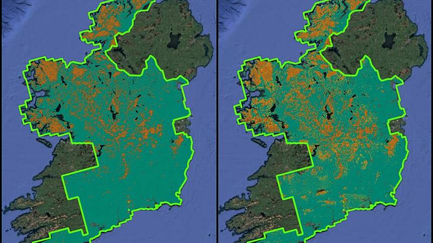
A study led by University of Galway has used gamma rays to create more accurate maps of peatlands nationwide.

Gamma Rays are invisible, high-energy photons released during natural radioactive decay of material in rocks and soils.

Peat soils have a unique ability to block this type of naturally occurring radiation.

Using a special sensor on a Tellus survey aircraft, the research team has now created a more accurate map of peaty soils across the country.

Advertisement
95.8 MHz Galway City
95.8 MHz Clifden & West Connemara
97.4 MHz South Connemara & Aran Islands
96.8 MHz County Galway
97.4 MHz East Galway
97.2 MHz Gort Area

Copyright © 2025. Developed by Square1 and powered by PublisherPlus.com

Download the GBFM App
Advertisement