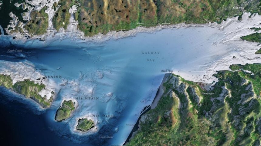
Galway Bay fm newsroom - A new series of coastal maps are showcasing Galway Bay and the Aran Islands in unprecedented detail.
INFOMAR has launched the Blue Scale Map Series - a collection of 18 super high-resolution maps of Ireland's coastal waters.
Ireland's coastline is over 3,000km in length and boasts some of the most unique and dynamic environments in Europe.
It's now the subject of new incredibly detailed maps, developed by a dedicated team of hydrographers, data processors and cartographers.
The Blue Scale Map Series is being launched through INFOMAR, one of the world's leading seabad mapping programmes.
It's a joint initiative by the Marine Institute in Oranmore and Geological Survey Ireland.
The series of 18 high-resolution maps is being released on a weekly basis - and the first map is of Galway Bay, now available to view at INFOMAR.ie.
The last map will be released on December 15th, and covers the Aran Islands of Inis Oirr, Inis Mór and Inis Meáin.